
Innovative technologies for local needs
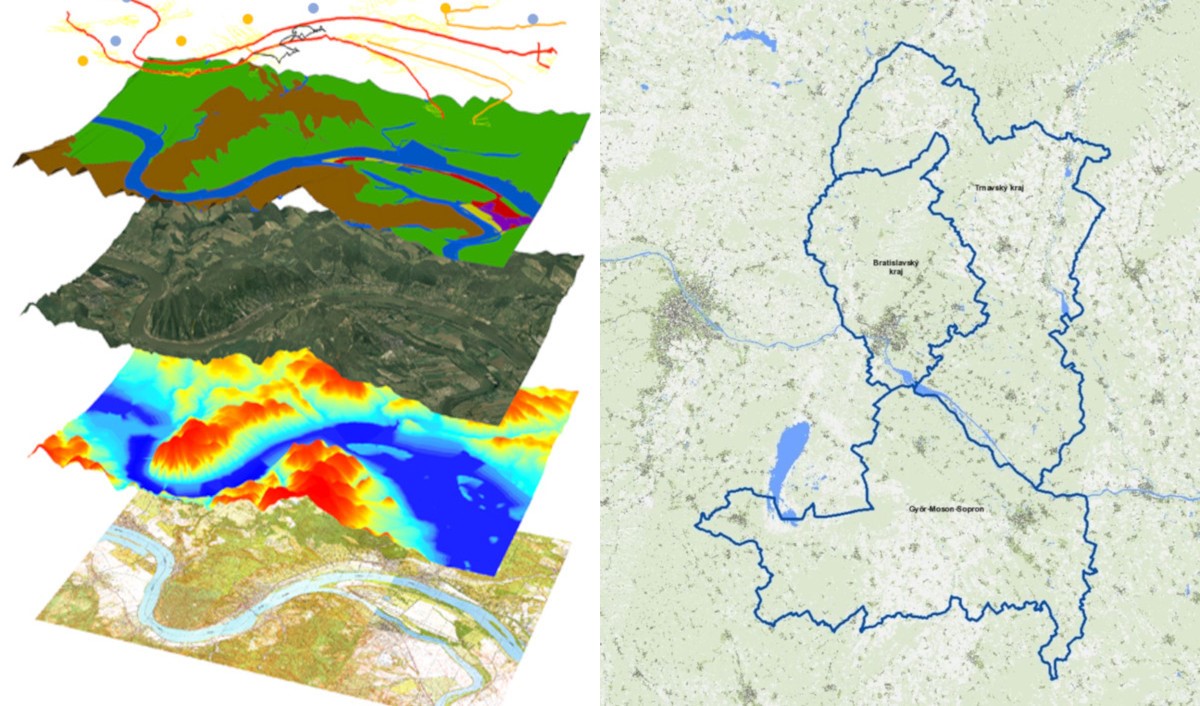
On January 28, the TP LAB project partners held a press conference and kick-off meeting. Within the framework of the project supported by the Interreg V-A Slovakia-Hungary Cooperation Programme, a GIS data and information service platform for the wider area of Szigetköz (Malý Žitný ostrov) and Žitný ostrov (Csallóköz) will be launched by the cooperation of the Institute of Spatial Planning (IPP), the Slovak Univerity of Technology in Bratislava (STU), West-Pannon Nonprofit Ltd. and Lechner Knowledge Centre.
The event was organized and moderated by Tibor Polgár, the head of West-Pannon Nonprofit Ltd. The task of the partner institution is to establish an information, training and test centre on the Hungarian side- the so-called Living Lab – and to transfer knowledge about the service to local stakeholders.
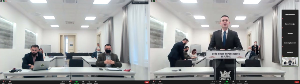
Győr-Moson-Sopron county has many joint projects with Bratislava and Trnava counties, such as water and bicycle tourism projects, developments oriented towards nature conservation and infrastructure, and various economic and social cooperation. „The areas on both sides of the border are in fact breathing together”, said Zoltán Németh, President of the General Assembly in Győr-Moson-Sopron County.
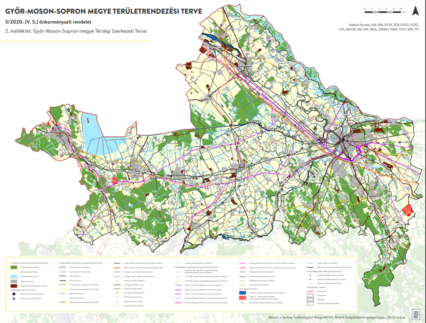
In connection with the 2019 revision of the National Spatial Plan, the county spatial plan was replaced with a more up-to-date version last year with the help of the Lechner Knowledge Centre. Accurate digital maps have been produced that are accessible to all and serves as a guide for planners as well as municipal leaders. Győr-Moson-Sopron County is growing dynamically, which indicates that the demand has increased for residential and industrial areas, but at the same time the area is extremely rich in natural assets.
One of the tasks of the county spatial plan is to reconcile these aspects. What is new is that specific zones have also been designated, such as metropolitan areas, the new zone of nature parks and flood risk areas.
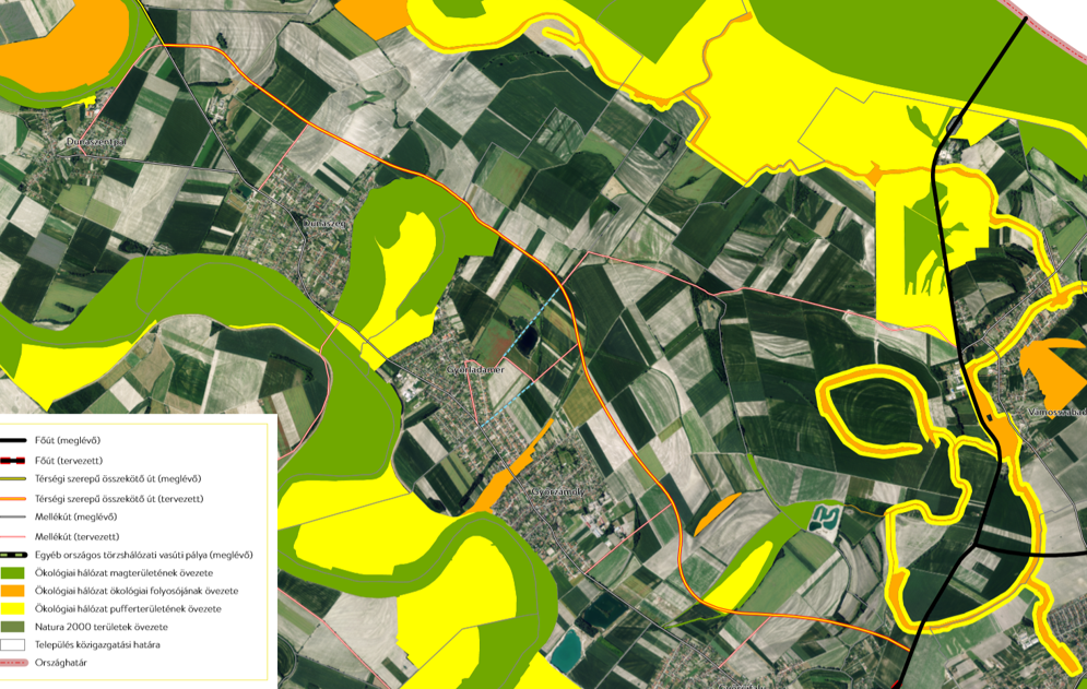
Adrienn Pappné Kett, Mayor of Győrladamér, a former chief architect of the county, presented the challenges of cross-border spatial planning and development from the perspective of a settlement. Győrladamér, first recorded in 1418, is located 10 km from Győr, in its agglomeration. The landscape in Szigetköz (Malý Žitný ostrov) has values that are very favourable from a tourist and economic point of view. The population is just over 1,800. The local development concept is now being developed under the slogan “A slice of Szigetköz” should answer the questions of a rapidly developing area that should remain liveable at the same time. Long-term, consistent planning is very important, as an example Adrienn Pappné Kett described several specific problems related to the planned road bypassing the settlement and the fragmented plot sizes due to more and more settlers. She emphasized – “It would be ideal to rethink long-term developments together where counties have a coordinating role that does not stop at the border”.
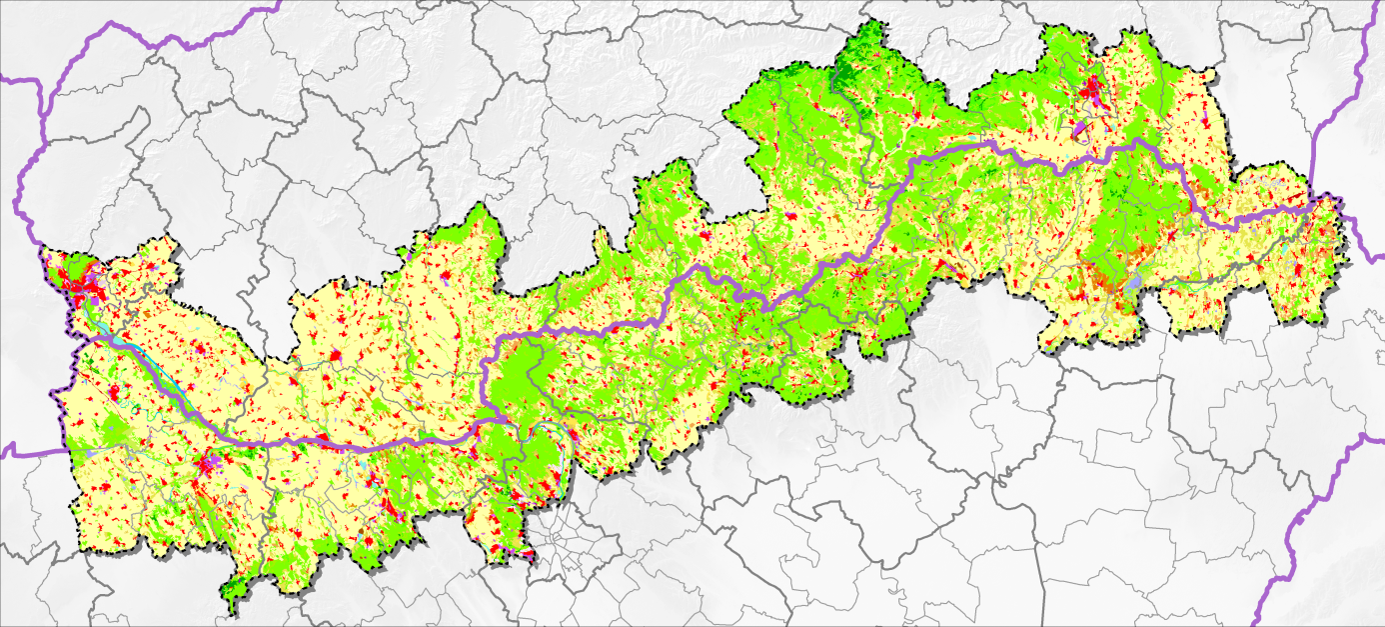
Lechner Knowledge Center has previously cooperated with the Institute of Spatial Planning (IPP - Inštitút Priestorového Plánovania) in the preparation of a Hungarian-Slovak border area study and the related web application”, said Anikó Devecseri, Head of the Spatial Planning Department.
The work consisted of three parts, starting with field studies, followed by SWOT analyzes and scenarios, and then recommendations. The scope of the study covered more than 1,600 settlements in 60 districts of 12 counties. The characteristics of society, economy, infrastructure and environment were studied, every topic including about a dozen sets of data. In the course of the work, the area proved to be so heterogeneous that, ultimately, it was not treated as one, but divided into three relatively homogeneous parts instead. The experience, results and data gained here can also be useful for TP LAB.
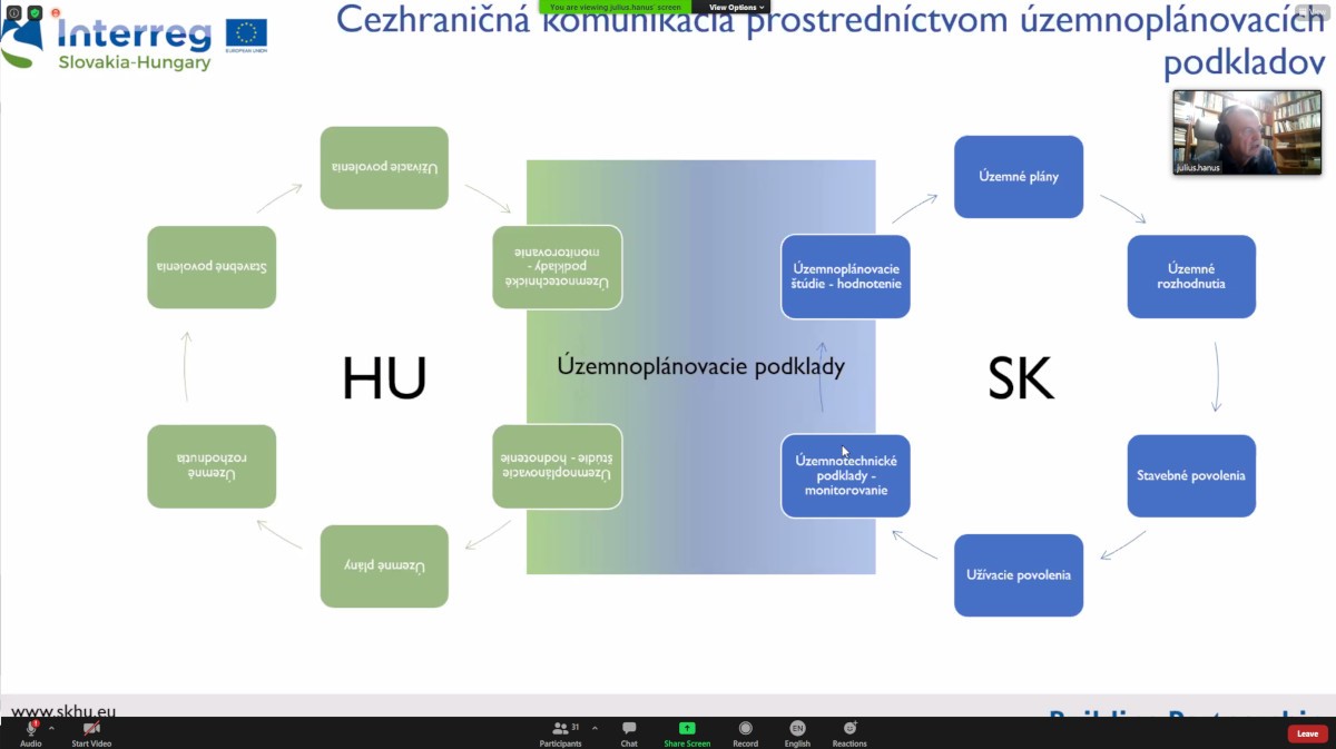
Július Hanus, Vice President of IPP, spoke about developments in the sharing of spatial planning data between countries in the first half of his presentation. He described the Slovak regional development system and highlighted the points that could be common and could help cooperation in regional development between the countries. Spatial development in Slovakia is characterized by the duality of spatial planning and regional policy, the former representing the technical, technical and the latter the social and economic components. In the second part of the presentation, he presented a previous project named Donauregionen, which can provide many lessons for TP LAB. The IPP presentation was continued by Filip Polonský on the topic of web maps. The data comes from a WMS data service, and the related tasks in the project will be performed by the IPP on the Slovak side and Lechner Knowledge Centre on the Hungarian side.
For the 2021–2027 programming period, a regional operational program is being prepared in Hungary, in addition to the sectoral programs. The Competitive Hungary Operational Program intends to respond to three main challenges, which are: territorial and regional differences, the division between the centre and the periphery, and the dominance of Budapest. As Csilla Horváth, head of department of the Ministry of Finance, said on behalf of the managing authority of regional development programs, the focus is on reducing territorial inequalities, connecting peripheral areas, relying on local resources, close cooperation between settlements and regions, and a more efficient, multipolar city network. Less developed areas and sustainable urban development will be given priority. The counties and the capital are working on updating regional development concepts and programs, and the related stakeholder consultation is currently underway. Among the first will be a call for the preparation of integrated settlement development strategies for settlements.
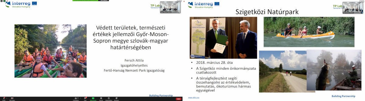
The Szigetköz Landscape Protection Area is the largest inland delta of the Danube, with special floodplain forests, bog and grove forests, swamps, reeds, lakes, which provide habitat for dozens of protected and highly protected plant species, as well as countless animal species. From Attila Fersch's presentation, the audience was able to get to know several other protected areas in detail, as well as locally protected natural areas and values, such as the Lipót-Darno horse chestnut avenue, or the 800-year-old Árpád oak tree in Hédervár with a circumference of 710 cm.
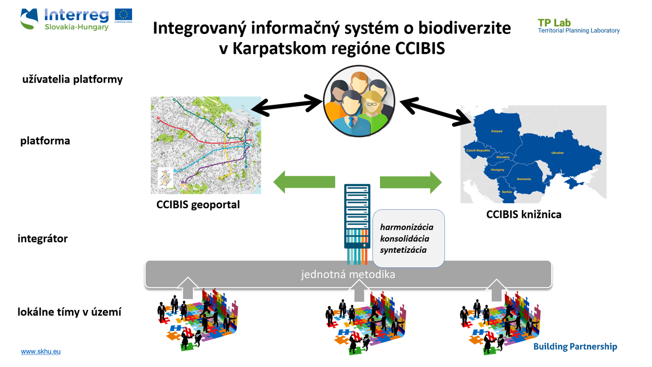
Vladimir Ondrejička, representing the SPECTRA Centre of the Technical University of Bratislava, presented the CCIBIS (Carpathian Countries Integrated Biodiversity Information System) platform. As he said, there are many programs and initiatives today that aim to collect and process data, valuable databases are being created, but the problem is that they are published on partial platforms, are not widely accessible, are not compatible with each other and do not have available information on their methodology. One should also keep in mind that these data may be important not only for professional users, but for ordinary users or municipalities as well. CCIBIS, the results of which can be transferred to the TP LAB project, integrates the data and results of four projects that have taken place or are still running in the Carpathian countries, in a fully open source platform, where the data can be downloaded or new data can be entered.
The Lechner Knowledge Centre is the largest organization in Hungary in the field of spatial data management, said Géza Juhász, Head of Department of the Planning and Spatial Data Services. Lechner has a wealth of data and innovative IT solutions that can support the TP LAB project. The TP LAB project primarily involves the Department of Planning and Spatial Data Services on behalf of the Knowledge Centre, whose main task is to prepare regulatory plans and building regulations, such as the National Spatial Planning Plan or the aforementioned Spatial Plan of Győr-Moson-Sopron County. As part of an ongoing project, the regulatory plans and building regulations of all municipalities in the country will be organized into a database and distributed to users in various applications after GIS processing.
Lechner's field of activity also includes the National Public Utility Register, but it also deals with satellite geodesy, for example, and has hundreds of thousands of design files and map repositories. Among the IT systems, OÉNY, TEIR and E-TÉR stand out. The company has very serious data assets, spatial data analysis capacity and an IT development team. In the TP LAB project, the task will be to develop a common GIS and data platform, coordinated and developed by Lechner.
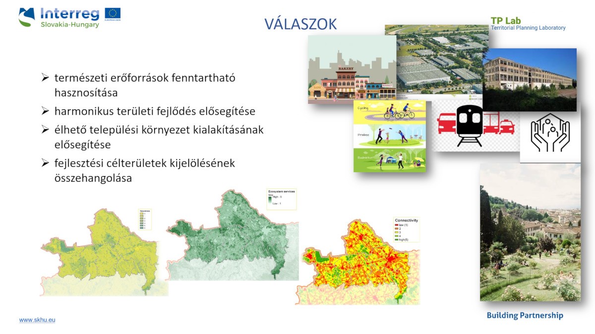
The focus of the TP LAB project is the increasing trend of agglomeration in the target area, the deteriorating quality of the urban environment, natural, landscape values and water management problems - Mariann Majorné Vén Mariann, senior regional planner and project manager of the Lechner Knowledge Centre, summed up the main challenges in her closing remarks. They try to provide answers to the problems with the methods of regional planning, during which the viewpoints of local residents, businesses and decision-makers must also be taken into account. The question is, in addition to the development plan, how well the digital services available today, the data and information generated by the development of technology, can meet local needs. How to make trade-offs in which economic and social expectations can be reconciled with environmental considerations, as green infrastructure also provides very valuable ecosystem services. It is a very short-term, in some respects pilot project, involving a wide-ranging partnership.
The afternoon session of the kick-off meeting started with the introductory presentations of IPP, West-Pannon Nonprofit Ltd. and SPECTRA Centre, and then the participating partners agreed on the professional tasks, schedule and technical and organizational details of the TP LAB project, with particular regard to the relatively short time. The presentations of the conference are available below on the TP LAB website in Hungarian or Slovak language. For further events and results you can also visit the facebook page of the project.
| Attachment | Size |
|---|---|
| 1. TPLAB_KettAdrienn_0.pdf | 3.66 MB |
| 2. TPLAB_Lechner_DevecseriAnikó_0.pdf | 6.53 MB |
| 3.1_TPLAB_IPP_JuliusHanus_0.pdf | 3.08 MB |
| 3.2_TPLAB_IPP_FilipPolonský_0.pdf | 2.49 MB |
| 4._TPLAB_PM_HorvathCsilla_0.pdf | 392.25 KB |
| 6._TPLAB_Spectra_VladimirOndrejicka_0.pdf | 903.83 KB |
| 7._TPLAB_Lechner_JuhaszGeza_0.pdf | 6.84 MB |
| 8._TPLAB_Lechner_MariannMajorVen_0.pdf | 1.16 MB |
| 5_TPLAB_NP_Fersch_Attila__0.pdf | 4.88 MB |