
Date: 31st March 2021; Form: online (MS Teams)
In order to present the project to a wider range of experts as well as potential end users, a meeting of key actors on the Slovak side took place at the end of March. Due to the ongoing pandemic and the associated limitations, this meeting took place online via teleconference. The event was attended by representatives from the Ministry (for the area of spatial planning), the regional self-government of the area, the academic sector, as well as experts in the field of spatial planning and GIS from the private sector.
The aim of the conference was, in addition to the presentation of the project and its expected results, also to identify the needs and opinions of key actors and potential users of project outputs.
At the beginning of the meeting, Ľubomír Macák, the project manager of the main cross-border partner of Institute of Spatial Planning (ISP), welcomed those present. He acquainted them with the program of the event - 1. Brief presentation of the project (goals and activities); 2. Expected results for stakeholders / spatial development practice and 3. Discussion. Then he presented basic information about the TP LAB project and the overall goal of the project TP LAB project.
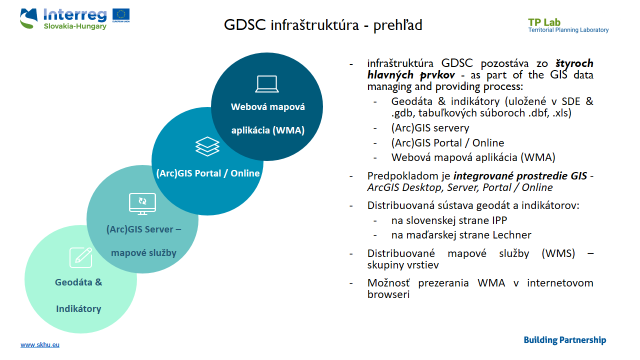
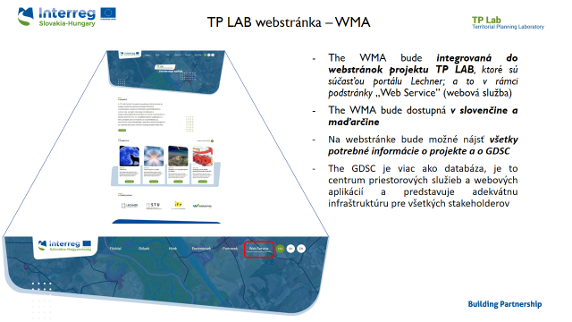
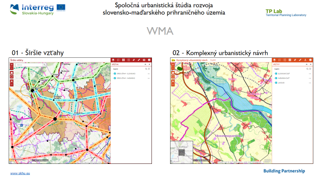
In the next part, GIS specialist of ISP - Filip Polonský, presented a more detailed structure of the second thematic activity (GIS data center) as well as an example of a similar activity implemented within previous IPP cross-border activities in cooperation with Lechner (Joint urban study of Slovak-Hungarian border). The activities within the TP LAB project will just follow up on the work carried out within this previous activity.
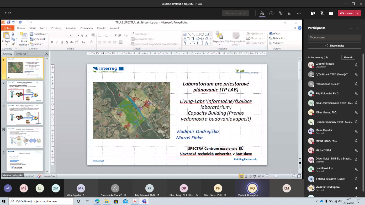
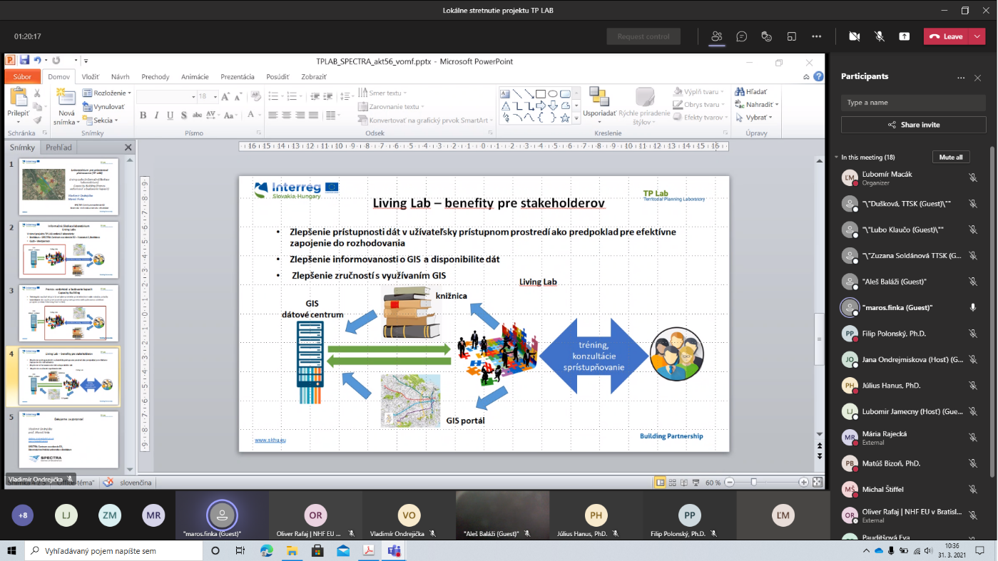
The presentation of the third and fourth thematic activities - Living-Labs (Information / Training Laboratory) and Capacity Building (Knowledge Transfer and Capacity Building) was presented by Vladimír Ondrejička, project manager of STU-SPECTRA EU Center of Excellence.
As part of the presentation of the GIS data center as a way to analytical and spatial data, Július Hanus, team leader and vice-chairman, the Institute of Spatial Planning presented the basic starting points for creating GIS data center as well as analytical data needed for spatial planning and planning as a process.
The project activities focused on the creation of the Information / Training Laboratory and Capacity Building were presented by Maroš Finka, Director, STU-SPECTRA EU Center of Excellence.
Discussion
Subsequently, a discussion was launched on the presented facts, which was focused mainly on:
- Structure (content) of required data
- Requirements / possibilities of using GIS, hardware, software
- Model of further maintenance and functioning of GIS data center and participation of users / stakeholders in updating and development of data center
- Information exchange requirements (SK-HU),
- Requirements for training (model solutions for the municipality / region)
During the discussion, Mr. Rajecká (Bratislava self-governing region), which drew attention to the current initiative of the state to amend the law, which deals with spatial planning and building regulations. In connection with this, a new office should be created, which will cover the area of spatial planning.
In connection with the creation of this new legislation, which also proposes significant changes in the competencies of individual entities of spatial planning, it is necessary to monitor these activities and possibly reflect them in the project outputs. Mr. Finka also confirmed that the project partners, STU-SPECTRA as well as IPP, are ready to act together in case of comments in relation to the draft law on spatial planning. At the same time, he expressed the opinion that the coordination of spatial information should fall under the responsibility of the Ministry of Investment, Regional Development and Informatization of the Slovak Republic.
Ms. Pauditšová (Comenius University in Bratislava) stated that it is necessary to share common views so as not to complicate spatial planning practice. At the same time, she pointed out the fact that there is still a problem with the provision of data by public (especially state) institutions and that there are still unresolved (inconsistent) issues related to geographical data (data) and cartographic data.
Mr. Finka noted that there was also a reluctance on the part of some private entities (administrators and owners of networks and related infrastructure) to share their data, which caused a problem in spatial planning. Therefore, it would be necessary to gain support in the legislation and give the obligation to provide this data.
Ľubomír Macák pointed out the existence of a register of spatial information and addressed those present with the question of what they have like with its use, resp. functioning of the experience. Ms Rajecká and Ms Pauditšová confirmed that they had provided some data for this register, but did not continue to use his information. Also within the project, the administrator of this register could be contacted in order to use the existing data.
At the same time, Ms. Rajecká confirmed the interest of the Bratislava Region in some way to participate in the project, especially as regards the provision of its own data for the region.
Ms. Pauditšová pointed out the information system of the Ministry of the Environment of the Slovak Republic for environmental impact assessment, which contains all planned investment plans that are planned to be implemented in the area. The information provided, when reasonably processed, could serve as a basis for the assessment of cumulative environmental effects throughout the territory.
Mr. Hanus informed the audience about the results of previous projects in which ISP participated, especially the specialized task prepared for the Nitra self-governing region (Study for evaluation and monitoring of the Spatial Plan of the Nitra Region), which also included a selection of indicators of the territory, processed the profile of each municipality, district and added data from the geographic information system - data of the spatial plan of the region. These works can be considered as a starting point for our further activities within this project. At the same time, Mr. Hanus confirmed that we will send the structure of this data to the individual participants. The system (portal) created in this way also enables the simulation of the development of the settlement environment - ie the evaluation of the impacts of key projects in the area on the development of the quality of the settlement environment (for a target year).
In the end, Ľubomír Macák thanked all participants for their participation and active discussion and confirmed that those present will be informed about the next steps in the project.
Determining the next steps:
Based on the results of the needs assessment on the Slovak and Hungarian sides, a summary analysis will be prepared, which will be available to the partnership.
A common database of data (indicators) will be created for the solved area on the Slovak and Hungarian side.
Web map services will be created (for the Slovak and Hungarian side).
Establishment of a Living Lab (local service office) (responsible partner: West-Pannon Nonprofit Ltd., Győr and STU-SPECTRA, Bratislava), in which the developed system can be tested in person, using the tools provided within the project and feedback can be given
Creating an online curriculum and organizing training to facilitate the proper use of the completed service.
| Attachment | Size |
|---|---|
| TP LAB needs assessment analysis, Slovakia | 559.95 KB |
| TP LAB needs assessment results presentation | 459.3 KB |